Strange giant barcodes can be seen from the skies across the US
- There are mysterious, giant barcodes across the US
- They can be spotted from an aircraft when flying overhead
- What they’re actually designed for might surprise you
Published on Nov 28, 2023 at 9:26 PM (UTC+4)
by Amelia Jean Hershman-Jones
Last updated on Dec 21, 2023 at 1:22 PM (UTC+4)
Edited by
Alessandro Renesis
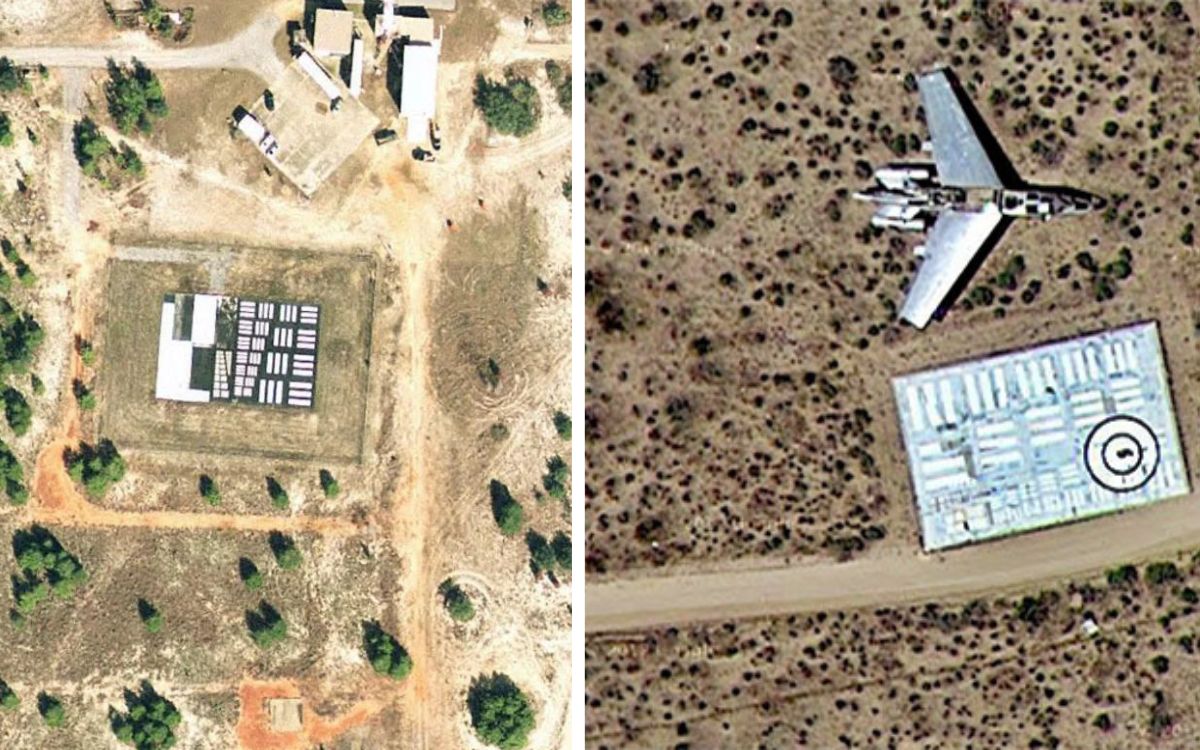
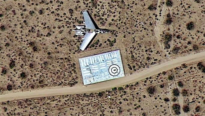
If you’re flying above the US you might spot what looks like mysterious giant barcodes below.
Dotted across the landscape, mostly near airforce bases, they look like QR codes for aliens.
Spoiler alert: they aren’t.
READ MORE! ‘New Concorde’ jet that flies from New York to London in 90 minutes set to make first flight
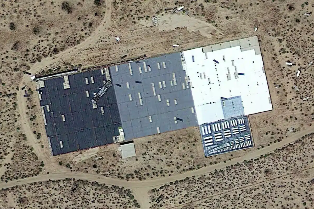
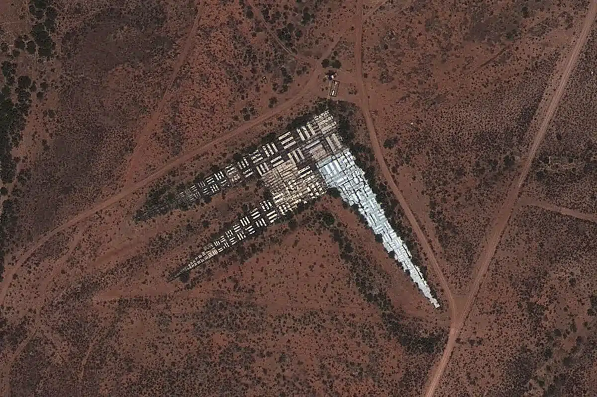
Embossed onto a panel of tarmac, they’re certainly not long-lost relics from ancient civilizations either.
In fact, these giant barcodes only hark back to the 20th century
These monochrome markings were actually used to calibrate the lenses of aerial and satellite cameras
The vast majority were made in the 1950s and 1960s.
That’s when the Cold War was starting to get a little heated.

The giant barcodes are actually a hangover from a US attempt to bolster its aerial reconnaissance and the technology behind it.
Come back to earth and from the ground you’ll notice that they’re usually situated on a flat pad of concrete or asphalt.
The black and white symbols are put into organised lines.
These stripes were used by planes and satellites.
The aircraft used their optical resolution to calibrate their imaging equipment.
While it’s a far cry from the eVTOLs, supersonic and camouflaged aircraft today – it was progressive for its time.
While it’s hard to get a sense of perspective from the air, they’re usually slightly smaller than a basketball court.
So how do they work?
“The targets function like an eye chart at the optometrist, where the smallest group of bars that can be resolved marks the limit of the resolution for the optical instrument that is being used,” say the Center for Land Use Interpretation (CLUI).
“For aerial photography, it provides a platform to test, calibrate, and focus aerial cameras traveling at different speeds and altitudes.
“The targets can also be used in the same way by satellites.”
It’s thought the targets were used to test formidable aircraft developed by the US during the Cold War period.
These aircraft include the SR-71 Blackbird and the U-2.
While they’re still in situ, modern technology doesn’t need to be calibrated in the same way.
So while there are still dozens of them lying across the landscape of the US – they’re no longer in use.
On the hunt for them?
They can be found near Eglin Air Force Base in Florida, the Nevada Test Site, Fort Huachuca in Arizona and Wright-Patterson Air Force Base in Ohio.
You can also look near Travis Air Force Base in California, Marine Corps Air Station Beaufort in South Carolina, and Shaw Air Force Base in South Carolina.
And this calibration technique wasn’t unique to the US.
In fact, internet sleuths were trawling Google Maps in 2011 and noticed strange structures in the Chinese desert.
Some were square, others zig-zagged, while a few consisted of giant characters from the Chinese alphabet.
While conspiracy theories abound, it was eventually revealed they were also there to calibrate China’s reconnaissance satellites.
As for the future of air travel technology, pilotless planes and SpaceX rockets seem to be the direction it’s heading in.
DISCOVER SBX CARS: The global premium car auction platform powered by Supercar Blondie

London-based Amelia cut her journalistic teeth covering all things lifestyle, wellness, and luxury in the UK capital. Fast-forward a decade and the senior content writer and editor has put pen to paper for glossy magazines, busy newsrooms, and coveted brands. When her OOO is on from writing about cars and heading up on-site SEO you can find her spending quality time with her young family, in the gym, or exploring the city she loves.