One person fed up with Google Maps and Waze builds his own app with a really smart feature that no one else is doing
Published on Jan 16, 2026 at 10:48 AM (UTC+4)
by Jason Fan
Last updated on Jan 16, 2026 at 5:11 PM (UTC+4)
Edited by
Mason Jones
In the Google Maps vs Waze showdown, another resource rarely gets mentioned, even though it’s what allowed one fed-up developer to rethink how navigation apps should work.
The developer decided to explore how navigation apps really work, and then take control of the system himself.
His curiosity quickly escalated into a fully functional navigation app, with a genuinely different idea at its core.
Along the way, he uncovered why even the biggest mapping apps still get plenty of things wrong.
SBX CARS – View live supercar auctions powered by Supercar Blondie
Toll roads are a particularly big concern
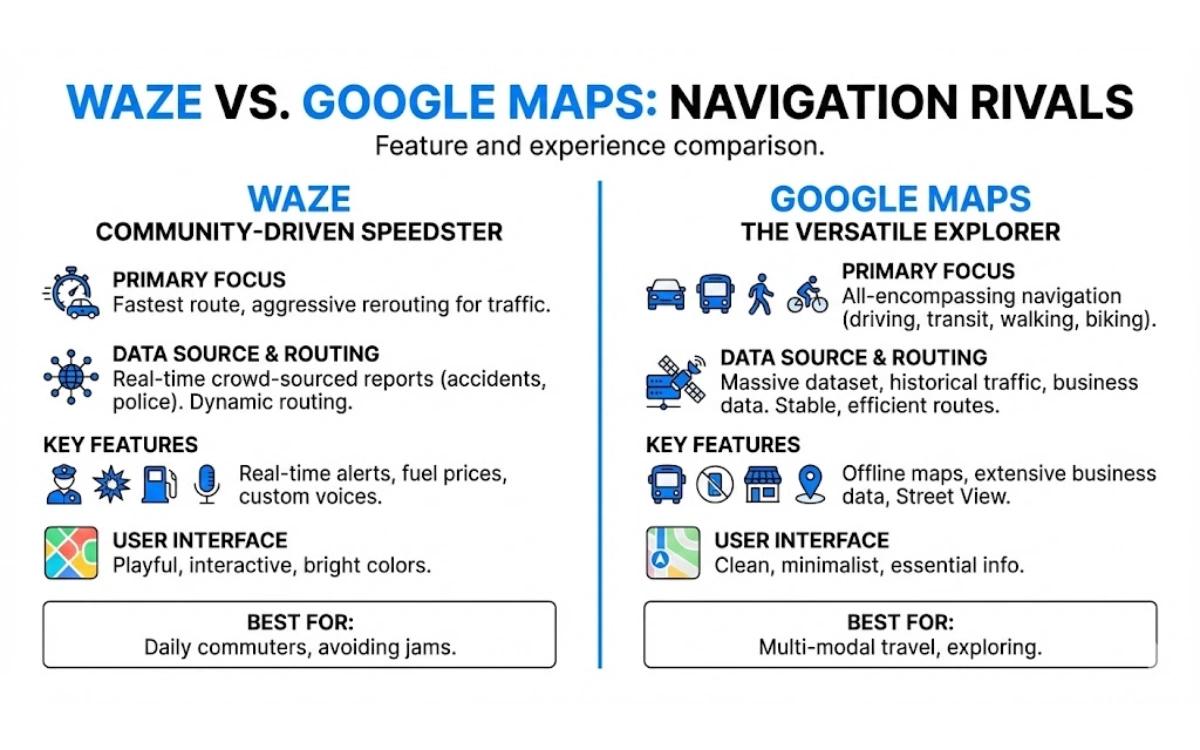
Google Maps and Waze each have their strengths, but also some clear weaknesses.
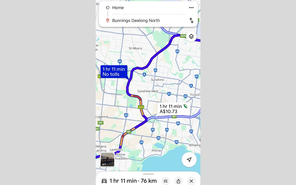
Google Maps excels at showing fast routes and traffic conditions, but it often pushes drivers onto expensive toll roads.
Sometimes, the app will offer the toll option even when it doesn’t save any time.
Waze, meanwhile, thrives on community data and shortcuts, but can direct drivers onto questionable detours through residential streets or rural tracks.
Because of these reasons, the man behind YouTube channel Railways | Retro Tech | DIY wanted an alternative.
According to him, both apps rely heavily on proprietary algorithms and opaque decision-making, leaving users with little control over what ‘optimal’ really means.
Enter OpenStreetMap, the open alternative.
Unlike commercial maps, OpenStreetMap gives users full access to the raw map data, road attributes, and routing logic.
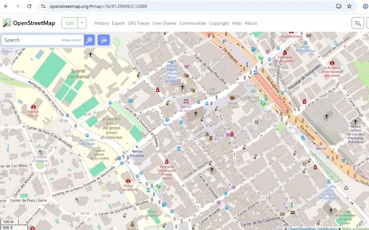
Using this data and an open-source routing engine called OSRM, the developer turned streets into a graph of nodes and edges, representing intersections and roads.
A particularly clever thing he did was to factor in the real cost of toll roads by converting toll prices into time.
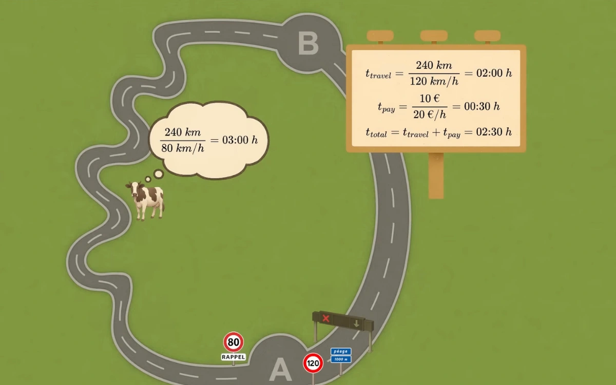
After all, driving a toll road might save minutes on the clock, but it also costs money.
In some cases, like the Oakland-San Francisco Bay Bridge, you’ll be paying a pretty ridiculous amount just to save some time.
That money represents time spent working to earn it.
By doing this conversion, the app chooses routes that balance speed, cost, and convenience in ways Google or Waze don’t.
Creating an app to challenge the Google Maps vs Waze debate
To make the app work, he studied the structure of French toll roads, which he calls ‘toll fortresses’, complete with entry booths, exit booths, and passthrough booths.
He combined this knowledge with OpenStreetMap data to generate custom ‘traffic weights’ for each road, essentially teaching the routing engine which roads to avoid unless absolutely necessary.
Even weird edge cases, like routes through forest tracks or tunnels under Mont Blanc, were manually corrected to ensure accurate results.
The final result is a navigation app that avoids unnecessary tolls and doesn’t spy on drivers.
While the app isn’t perfect, and it’s not available worldwide, this is still proof that one person can rethink a system that billion-dollar companies still struggle with.

Forget the Google Maps vs Waze debate; maybe what’s needed is some new blood to challenge the status quo.
In fact, there are already other navigation apps in the market, some of which already offer game-changing features.
DISCOVER SBX CARS: The global premium car auction platform powered by Supercar Blondie