Footage from 1991 shows tech experiment from Florida could talk you through traffic decades before our modern GPS systems
Published on Oct 17, 2025 at 1:40 PM (UTC+4)
by Jason Fan
Last updated on Oct 17, 2025 at 1:40 PM (UTC+4)
Edited by
Kate Bain
Before Google Maps and Waze, there was TravTek: the first GPS-based tech experiment that could literally talk you through traffic.
The year was 1991, and the location was Florida.
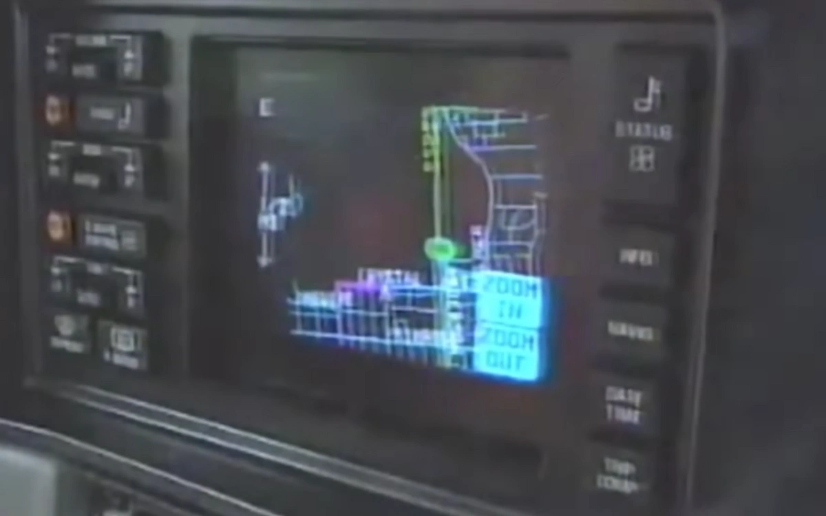
In the age of cassette tapes and flip phones, a fleet of futuristic Oldsmobiles roamed Orlando with glowing screens on their dashboards.
What they did would end up changing driving forever.
SBX CARS – View live supercar auctions powered by Supercar Blondie
The first GPS allowed you to receive live updates back in 1991
TravTek, which is short for ‘Travel Technology’, was a bold collaboration between General Motors (Oldsmobile Division), the American Automobile Association (AAA), the Florida Department of Transportation, and the U.S. Federal Highway Administration.
Together, they set out to test something almost unimaginable at the time: a computer that could tell you where to go.
Around 100 specially equipped Oldsmobile Toronados were fitted with CRT displays and onboard computers linked to GPS and dead-reckoning sensors.
These sensors help to keep track of your location, even when satellites went dark.
Drivers could punch in a destination and watch as digital arrows guided them through the streets of Orlando.
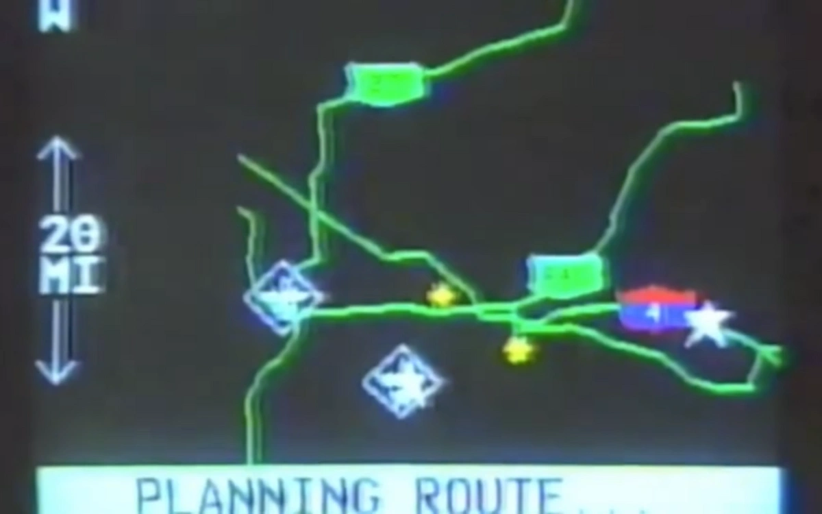
Turn-by-turn voice prompts gave spoken directions, decades before ‘recalculating’ became part of our daily vocabulary.
But the real magic was how connected TravTek was.
The cars didn’t just rely on static maps.
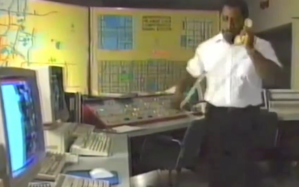
Instead, they communicated to a central traffic information center, that sent live updates about accidents, road closures, and congestion.
If this sounds familiar, that’s because this was essentially real-time traffic navigation before the internet made it cool.
TravTek’s networked cars could reroute drivers around bottlenecks and construction, something that wouldn’t become mainstream until apps like Waze appeared nearly 20 years later.
TravTek laid the foundation for future navigational systems
Of course, given that it was 1991, the system wasn’t perfect.
The graphics were primitive, and the interface sometimes baffled test drivers.
Some loved the idea, while others were too distracted by the blinking CRT to use it.
Still, the tech experiment proved something vital: people wanted electronic maps, and voice-guided navigation could actually work in the real world.
When TravTek wrapped up in 1992, its data didn’t disappear.
The findings directly inspired systems like GM’s OnStar and laid the groundwork for future navigational systems like Google Maps.
DISCOVER SBX CARS: The global premium car auction platform powered by Supercar Blondie