This 2021 Google Maps image is sparking theories there’s a black hole forming in the Pacific Ocean
- Google Maps’ Satellite images leave people shocked at a ‘black hole’
- But it was soon debunked to be Vostok Island
- There’s actually a very good reason that it looks like a wormhole
Published on Feb 25, 2025 at 11:57 AM (UTC+4)
by Jack Marsh
Last updated on Feb 25, 2025 at 11:57 AM (UTC+4)
Edited by
Kate Bain
Back in 2021, some satellite images from Google Maps sparked the theory there was a black hole forming in the Pacific Ocean.
So much of our globe is still yet to be explored, especially across the oceans, but now satellite images from space have uncovered what looks very much like a black hole.
However, despite sparking massive online debate, it was later debunked and revealed to be something else entirely.
And as it turns out, there was a very good reason it looked like a black hole.
DISCOVER SBX CARS: The global premium car auction platform powered by Supercar Blondie
Vostok Island: The Google Maps black hole
Google Maps is renowned for finding some rather interesting sections of this massive world we live in.
Previously, a random runway was spotted in the jungle in South America, leaving people bewildered given its extremely remote location.
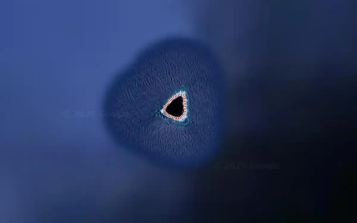
In 2021 though, the Satellite feature on Google Maps sparked controversy, as one person shared a black triangular shape spotted in the Pacific.
Quickly adopted on Reddit as a ‘black hole’, the object was nearest to Samoa, but was a straight line down from Hawaii, and was an easy miss to most people given the lack of land that spans through the Pacific.
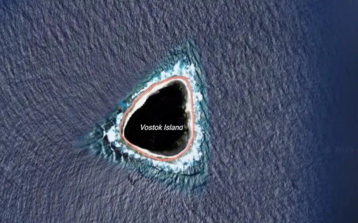
However, it was soon found to be Vostok Island.
The blackness is a strange reflection, but the small triangle of land is an uninhabited coral island filled with trees.
Why it looked so black on Google Maps is no mystery either.
A study dating back to 1971 found that the island was home to Pisonia trees that grew so dense that the floor was always in shadow and nothing could grow underneath it.
There’s no freshwater on the island for the same reason.
Vostok Island has been traveled too though.
It was first found in 1820 by a Russian Explorer, and among its visitors over the years was the National Geographic Channel.
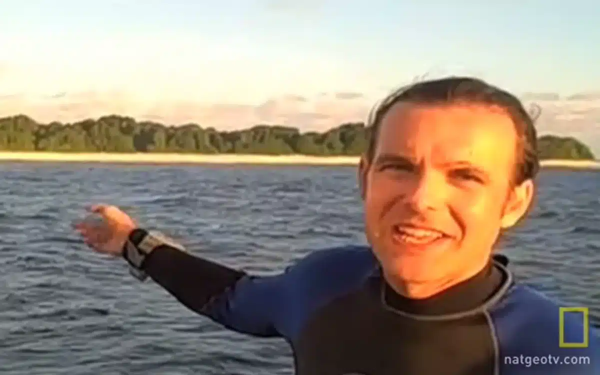
The channel posted a small clip to YouTube in 2009 after Enric Sala explored the nearby coral, filled with fish and sharks.
To this day, the ‘black hole’ remains visible on Google Maps, although it is now known to not be a wormhole that would destroy Earth and the entire Milky Way universe.
People use Google Maps for all kinds of exploration nowadays, with one man using its picture features to track down abandoned cars.
After beginning his career writing about all things gaming, Jack joined the Supercar Blondie team in November 2024 as a Content Writer. Since joining SB Media, in addition to a love for covering emerging tech, he has developed an admiration for vintage restorations, particularly old American brands like Dodge and Ford.